
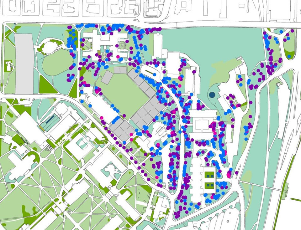
A detailed digital model of the University of Washington's existing trees and vegetation helped us quantify their performative and environmental value and make the case for preservation.
At KieranTimberlake, we believe the best architecture is responsive to not only its site and surroundings, but to its people as well. Our design process combines both occupancy research—direct observations investigations into how and why real occupants use a space—and environmental research into microclimate, topography, environmental quality, and existing trees, vegetation, and other landscape elements. These kinds of research often necessitate custom mapping and surveying, as well as bespoke tools and techniques for recording and analyzing user behavior across a range of scales, timeframes, and interior and exterior conditions.
Melding techniques from the fields of ecology, landscape architecture, anthropology, and environmental studies, our customized methodologies quickly and accurately capture complex site information. This gives us a complete picture of each site's opportunities and constraints early on in design so that we can integrate building performance strategies, minimize environmental disturbance, and better quantify and incorporate holistic ecosystem services.
Campus Tree Canopies
During a campus planning project at the University of Washington, for example, we built a detailed digital model of the site's existing trees and vegetation in order to decrease the environmental impact of the new construction. This model also helped us make the case for tree preservation by allowing us to quantify the existing trees' performative value—armed with an accurate representation of existing vegetation, we were able to calculate exactly how much the tree canopies reduced energy demand and increased thermal comfort, and also developed an understanding of how much rain and stormwater they absorbed in an effort to minimize disturbances during construction. This information later allowed us to help the client take full advantage of the site's ecosystem services and forest canopy.
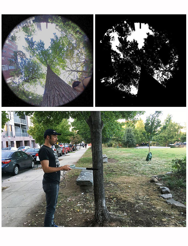
By measuring existing trees, our design teams can better represent landscape features in analysis models. This gives us a more complete picture of the site and also allows us to quantify how the landscape contributes to sustainability via carbon absorption, stormwater management, biodiversity, and energy savings through shading.
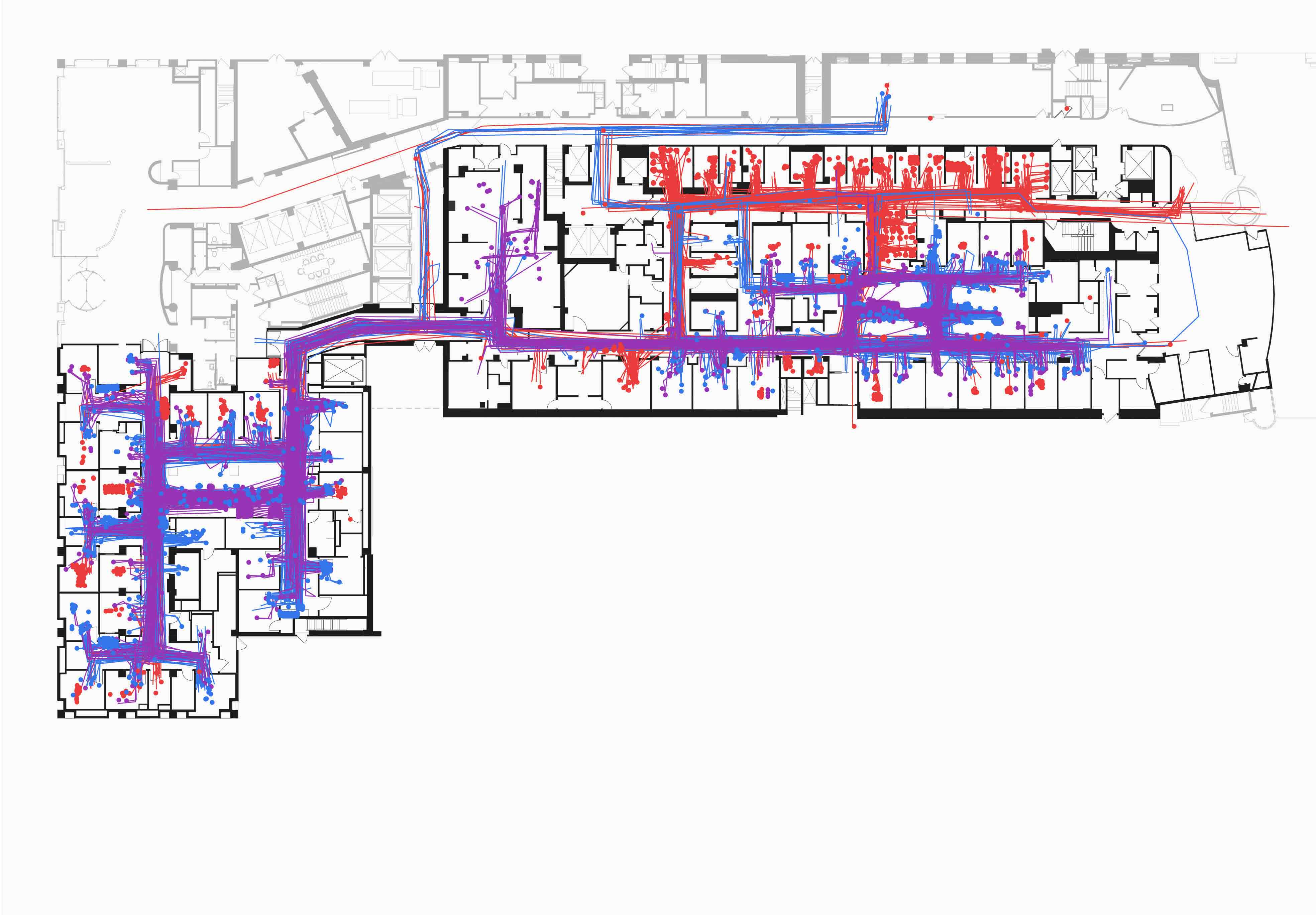
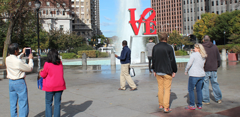
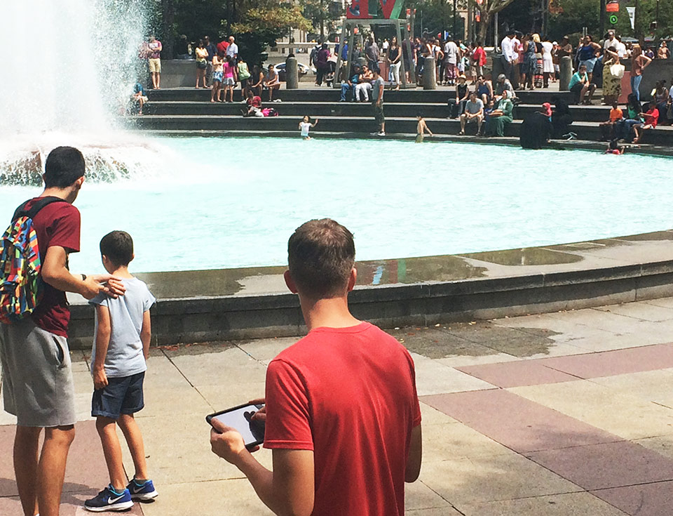
Park Occupancy
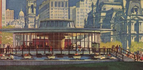
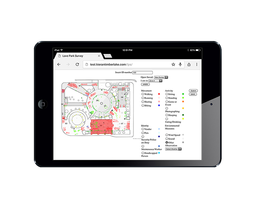
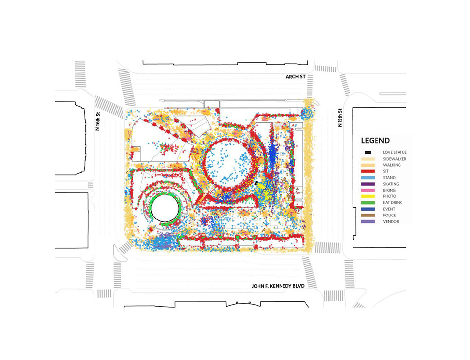
Another example of our mapping and surveying work can be found in Philadelphia's LOVE Park, an iconic public space that houses Robert Indiana's LOVE sculpture. With this beloved community landmark set to undergo significant renovations, our team undertook a separate study of the site to understand how visitors use and move through the existing space throughout the day. This included what activities they partake in, how they socialize, what movement patterns exist, and what areas of the park are most popular. We also gathered information on how the park's features, temperature, and microclimate affected visitors' behavior. Ultimately, this data makes possible a future post-occupancy survey by creating a pre-renovation standard against which the new design could be compared.
Interested in learning more about how mapping and surveying influences design? Click on the Related Updates below, or visit our Research page to read more about on-going and completed projects.